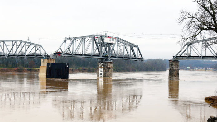
 Clarksville, TN – Clarksville and Adams, Tennessee, are experiencing significant flooding as rising water levels threaten homes, businesses, and infrastructure. Heavy rainfall in recent days has led to swelling rivers, pushing water into agricultural fields, residential neighborhoods, and commercial districts.
The National Oceanic and Atmospheric Administration (NOAA) has reported that both the Cumberland River and the Red River are expected to crest between Sunday, February 16th, and Monday, February 17th, before beginning to recede.
Cumberland River Flooding in Clarksville
The Cumberland River at Clarksville is projected to crest at 51.6 feet on Monday, February 17th, around 6:00am, resulting in moderate flooding throughout the area. While water levels will begin to recede later that night, around midnight, the effects of the rising water have already been felt. At 50 feet, widespread flooding impacts much of the city’s industrial and commercial properties, particularly those along Riverside Drive near TN-48, Providence Boulevard, McClure Street, and Cumberland Drive. McGregor Riverfront Park, a popular recreational area, is also underwater.
Several key roads in Clarksville have already been affected, including Quarry Road, Kraft Street near College Street and Providence Boulevard, Zinc Plant Road, Salem Road, and Seven Mile Ferry Road. Water has reached athletic fields near Greenland Farms Drive and is threatening homes and properties along Branch Road. Emergency response teams are monitoring these areas closely and urging residents to remain cautious when traveling near flooded zones.
Red River Flooding in Adams
The situation is even more severe along the Red River near Port Royal in Adams, TN, where water levels are expected to crest at 45.9 feet on Sunday, February 16th, at 6:00pm. This level of flooding is classified as major flooding, with water reaching multiple residential areas and causing significant disruption.
At 44 feet, floodwaters begin encroaching on homes along Rivermont Drive, River Run, Idlewood Drive, and Wimbledon Court, while also flooding yards in neighborhoods along Colin Court, East Accipiter Circle, Pond Apple Road, Foxfire Road, Hay Market Road, and Riverhaven Drive. In addition, water has reached the Port Royal State Park Trail of Tears Trailhead parking area and is threatening properties on Stonegate Drive and Willow Bend Drive.
Residents in affected areas are urged to take precautions, including securing belongings, avoiding floodwaters, and following guidance from emergency management officials. With both rivers expected to begin receding after their respective crests, the community is hopeful that damage will be minimized. However, officials continue to stress the importance of vigilance, as conditions can change rapidly.
Ongoing Monitoring and Safety Precautions
As floodwaters rise and roads become impassable, local authorities are urging residents to stay informed and avoid travel in flooded areas. Flooding of this magnitude poses dangers beyond property damage, including strong currents, road washouts, and contamination of water supplies. Emergency responders are on standby to assist those in need, and officials will continue monitoring conditions as the situation evolves.
While floodwaters are expected to begin receding early next week, the cleanup and recovery process will take time. Residents should prepare for lingering high water levels in low-lying areas and be mindful of potential infrastructure damage. The community is encouraged to remain cautious and take necessary precautions as Clarksville and Adams work through the impacts of this significant flooding event.


