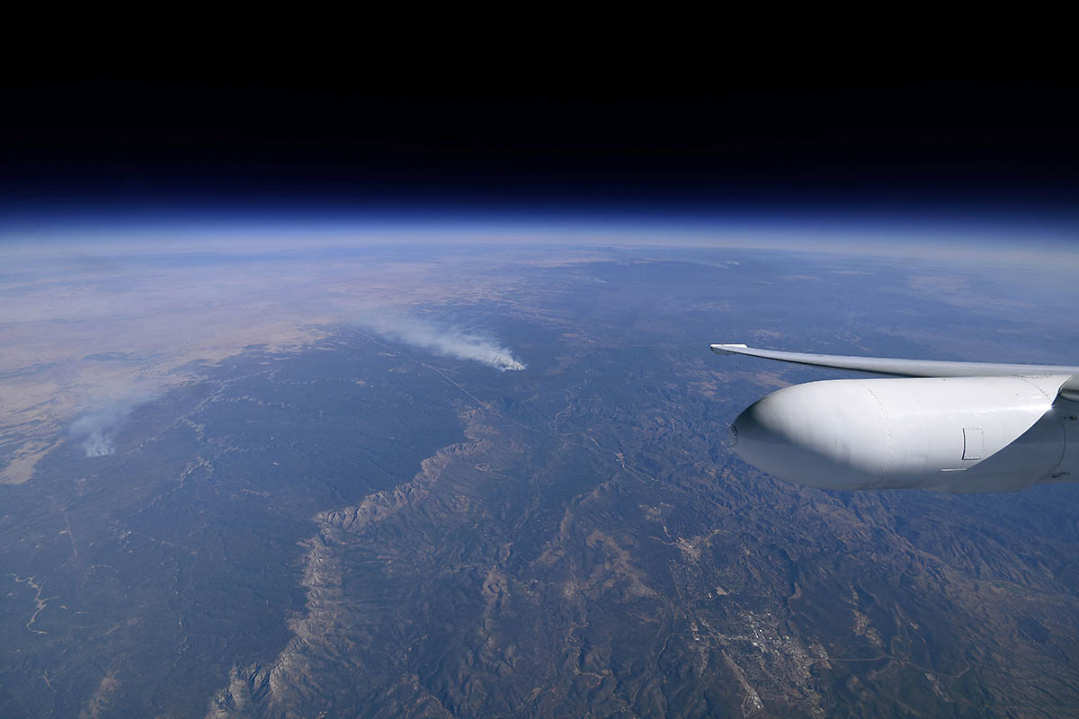
The view from NASA’s ER-2 flying at approximately 65,000 feet (19,812 meters) near a controlled fire burning near Flagstaff, Arizona, during the Aerosol Characterization from Polarimeter and Lidar (ACEPOL) airborne campaign on Nov. 7, 2017. (NASA/Stu Broce)
Home The view from NASA’s ER-2 flying at approximately 65,000 feet (19,812 meters) near a controlled fire burning near Flagstaff, Arizona, during the Aerosol Characterization from Polarimeter and Lidar (ACEPOL) airborne campaign on Nov. 7, 2017. (NASA/Stu Broce) The view from NASA's ER-2 flying at approximately 65,000 feet (19,812 meters) near a controlled fire burning near Flagstaff, Arizona, during the Aerosol Characterization from Polarimeter and Lidar (ACEPOL) airborne campaign on Nov. 7, 2017. (NASA/Stu Broce)
The view from NASA’s ER-2 flying at approximately 65,000 feet (19,812 meters) near a controlled fire burning near Flagstaff, Arizona, during the Aerosol Characterization from Polarimeter and Lidar (ACEPOL) airborne campaign on Nov. 7, 2017. (NASA/Stu Broce)