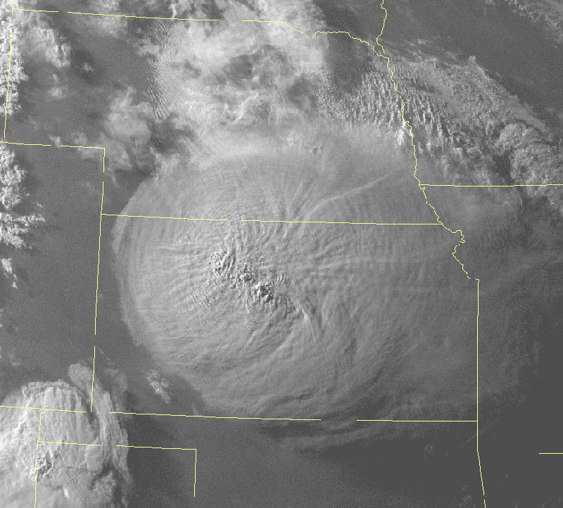
A satellite image of a supercell thunderstorm with overshooting tops over Kansas. (Credit: NWS)
Home A satellite image of a supercell thunderstorm with overshooting tops over Kansas. (Credit: NWS) A satellite image of a supercell thunderstorm with overshooting tops over Kansas. (Credit: NWS)
A satellite image of a supercell thunderstorm with overshooting tops over Kansas. (Credit: NWS)